Maps are an important way of life. What would we do without them? Some people with amazing senses of direction have no problem getting around but those of us who have problems with east and west, who cannot go anywhere without their Garman map and direction finder, are not as lucky!
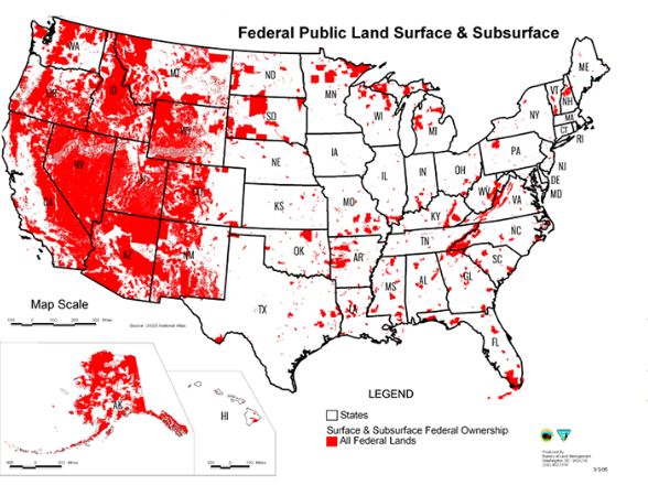
However, come to find out there is one map circulating in political groups that misrepresent the authenticity surrounding America’s public lands! It is called the red map and we will tell you why in a bit.
The point is, wherever you see a political group who is in favor of moving public lands out of the federal domain, a map is created and is distributed by the American Lands Council. This is a Utah-based group that is completely against the federal land estate.
After the break, go over to the next page and read more about this controversial topic!
They want total control of the high ground.
Can somebody explain why the Feds need to own almost the entire states of Nevada, Arizona and Utah?
The Feds can’t control any land in Texas, every base or Federal installation is leased from the state to the government, so this map is a lie!!!
Nuclear testing / radiation. Oh and aliens too haha